Hike · Tarn
Vignoble et châteaux
17.4 km5h12+425 mModerate
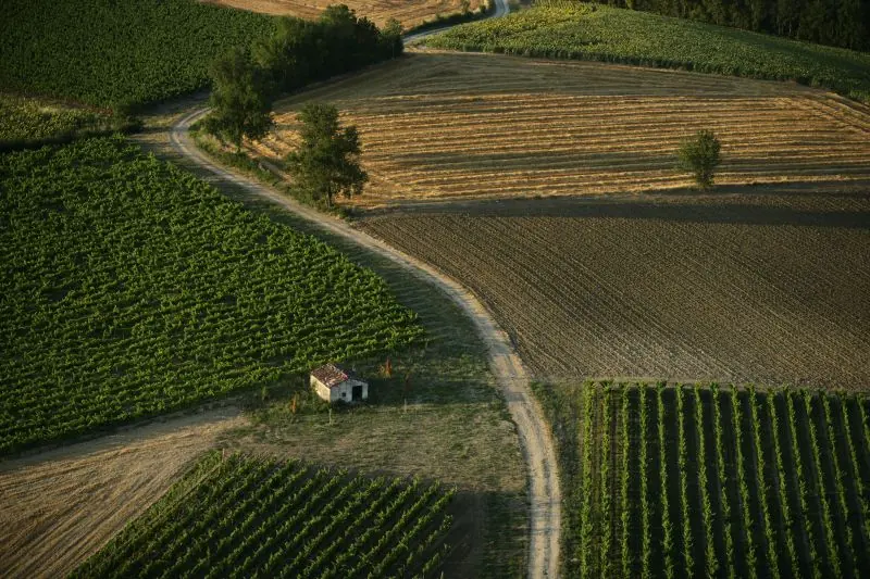
The trail winds through the hills of Gaillacois, where the vineyard, prominent in the landscape, is marked by its undulating rows. The hiker will discover a noble heritage (castles) and a viticultural one (vine huts, dovecotes, farm cellars).
Description provided by CD Tarn (Tarn Pleine Nature).
Getting there by train
The start of the trail can be reached on foot from the station, without a car.
- Tessonnières station · 32 min walk
Travel time from the main stations
- Toulouse Matabiau 52 min by train
- Perpignan 4h00 by train
- Béziers 3h29 by train
- Tarbes 3h27 by train
- Carcassonne 2h29 by train
- Agen 2h44 by train
Indicative times from SNCF GTFS data. Actual times, there and back, are worked out on the interactive map.
Other hikes from Tessonnières
Data source
Data produced by CD Tarn (Tarn Pleine Nature), updated on 10 July 2026
Caminada lists trails, not their access status in real time. Always check the local situation (prefectural orders, weather, works) before you set off.