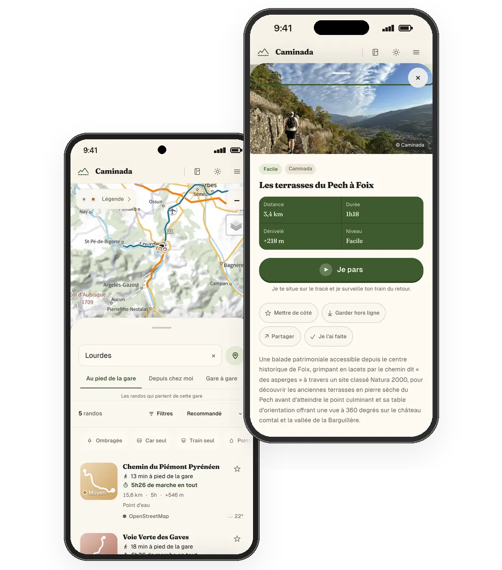
How it works
- 1Four questions
Where you start from, how (on foot from the station, by train or bus to another starting point, or from one station to another), when, and which hike. The distance between the station and the trail is measured along paths and streets.
- 2Everything about the hike
Each hike page gives the distance, elevation gain, time, difficulty, elevation profile, share of shade, best season, water points and points of interest, the track on the IGN map, the weather at the destination and the GPX file. Caminòt, the mascot, sums up at the top what to plan for.
- 3Getting there and back
Your round trip is worked out from your station: the train or bus there, the time of the return and your time to spare, with the timetable of the day you choose.
- 4On the trail
"I'm off" shows where you are on the route, works out the remaining distance and follows the train home, SNCF delays included, or the scheduled time of the liO bus. A hike kept offline stays readable without network.
The apps
Caminada is coming to Android and iPhone on Tuesday 27 October. The apps show the same hikes and timetables as the site.
Where the data comes from
The routes come from the open data of national and regional parks, départements (Geotrek, PDIPR) and OpenStreetMap. Each hike page shows its source and licence. Timetables come from SNCF and the Occitanie Region (liO network).
The site is free and shows no advertising. Audience measurement runs on the site's own server, without cookies. Caminada is developed by Paul Janisson, in Toulouse.